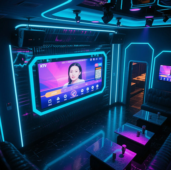
I display delle mappe della metropolitana sono strumenti di navigazione essenziali per milioni di utenti quotidiani, guidare pendolari e turisti attraverso complesse reti di transito. Eppure le tradizionali mappe statiche o le ingombranti interfacce digitali spesso creano confusione: i ciclisti faticano a trovare percorsi, perdere i dettagli del trasferimento, o non riescono ad accedere agli aggiornamenti del servizio in tempo reale. These pain points lead to frustrated passengers, increased staff workload, and disrupted transit experiences—especially during peak hours or service disruptions.The Subway Map Touch screen transforms subway navigation by merging interactive functionality with transit-grade durability.
Designed specifically for high-traffic stations, this touch screen delivers intuitive route planning, real-time service alerts, and multi-language support with just a few taps. It withstands heavy use, illuminazione dura, and environmental stressors, making it ideal for both indoor and semi-outdoor subway stations. Whether deployed in busy urban transit hubs or regional subway systems, this touch screen empowers riders to navigate independently and efficiently. Questo articolo ne analizza le caratteristiche principali, benefici, applicazioni, and FAQs to show how it revolutionizes subway map displays.
Core Features of Subway Map Touch Screen
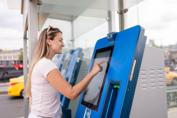
1. Intuitive Interactive Navigation & Route Planning
Simplifies complex subway networks for riders of all familiarity levels:
Point-to-point route search: Riders input start and end stations to get step-by-step directions, including transfer points and travel times.
Zoom & pan functionality: 10-point multi-touch support lets users zoom in on station details or pan across the entire network effortlessly.
Station detail display: Tapping a station shows exits, nearby landmarks, accessibility features (wheelchair ramps, elevators), and connecting bus routes.
Favorite routes save: Riders can store frequently used routes for quick access during daily commutes.
This interactivity eliminates guesswork, letting riders plan journeys in seconds without staff assistance.
2. Durabilità di livello transitorio & Resistenza ambientale
Built to handle the rigors of high-traffic subway stations:
Protezione frontale IP65: Sigillato contro la polvere, piovere, and spills (per esempio., bevande, cleaning agents), perfect for semi-outdoor platforms or busy lobbies.
9Superficie in vetro temperato H: Resists scratches from bags, chiavi, e impatti accidentali, withstanding heavy daily use from hundreds of riders.
Antiriflesso & display ad alta luminosità: 1,200 nits brightness cuts through direct sunlight and station lighting, while anti-reflective coating ensures clarity.
Ampia tolleranza alla temperatura: Operates reliably from -20°C to 60°C (-4°F a 140°F), fitting cold underground stations and hot outdoor platforms.
Questa durabilità garantisce 24/7 funzionamento con una manutenzione minima, anche negli snodi di transito più trafficati.
3. Real-Time Service Integration & Alerts
Keeps riders informed about subway operations and disruptions:
Live service updates: Syncs with transit management systems to display real-time train arrival times, delays, and route changes.
Color-coded alerts: Highlights disruptions (detours, closures, overcrowding) with bold notifications to help riders adjust plans.
Emergency announcements: Integrates with subway PA systems to display critical alerts (safety drills, incidents) directly on the screen.
Scheduled maintenance alerts: Notifies riders of upcoming service changes in advance to avoid last-minute delays.
This feature ensures riders stay informed and can make timely decisions about their journeys.
4. Multi-Language & Accessibility Support
Caters to diverse riders, compresi i turisti e le persone con disabilità:
20+ opzioni linguistiche: Offre inglese, spagnolo, Mandarino, arabo, francese, and more to serve international tourists and multilingual communities.
Funzionalità di accessibilità: Modalità ad alto contrasto, text-to-speech compatibility, and large font options for riders with visual impairments.
Wheelchair-accessible routes: Identifies fully accessible stations and routes for riders with mobility needs.
Simple icon-based design: Reduces language barriers with universal icons for routes, transfers, e servizi.
This inclusivity ensures every rider can use the map display independently, regardless of background or ability.
5. Gestione remota & Approfondimenti operativi
Eases transit agency workflows and optimizes display performance:
Aggiornamenti remoti dei contenuti: Transit teams push map updates, service changes, or new language options without on-site visits.
Real-time status monitoring: Tracks screen performance, reattività al tocco, and connectivity to identify issues early.
Analisi dell'utilizzo: Captures data on popular routes, peak usage times, and language preferences to optimize display placement and features.
Modalità di blocco remoto: Enables secure shutdown during emergencies or maintenance periods to protect the screen.
This functionality reduces downtime and cuts operational costs for transit agencies.
Key Benefits of Subway Map Touch Screen
1. Enhance Rider Satisfaction & Reduce Inquiries
A smoother navigation experience translates to happier riders and lighter staff workloads:
Cut journey planning time by 50%: Intuitive tools let riders find routes faster, reducing frustration during peak hours.
Minimize staff assistance requests: Self-service navigation frees staff to focus on critical tasks (per esempio., assistere i ciclisti disabili, gestire la folla).
Cater to tourists: Multi-language support and simple interfaces make subway systems accessible to international visitors.
Improve transit reputation: Moderno, interactive maps create a positive first impression of the subway network.
2. Costi operativi inferiori & Maintenance Efforts
Transit agencies save time and resources with a durable, low-maintenance solution:
Reduce maintenance visits: Il design robusto e la diagnostica remota eliminano 50% delle chiamate di riparazione in loco.
Extend display lifespan: I componenti di livello industriale durano 5-7 anni, outperforming consumer-grade touch screens.
Optimize staff allocation: Usage analytics help place displays in high-demand areas, maximizing their utility.
Cut update costs: Remote content updates avoid the expense of replacing static maps or sending teams to each station.
3. Improve Transit Efficiency & Crowd Management
Streamlines passenger flow and reduces congestion in stations:
Reduce crowding at information desks: Riders use touch screens instead of clustering around staff for directions.
Speed up decision-making: Real-time alerts let riders adjust routes quickly, preventing bottlenecks at stations.
Optimize transfer flow: Clear transfer directions help riders move between lines efficiently, reducing platform overcrowding.
Support contactless options: Integrates with QR code scanners, letting riders save routes to their phones without repeated touch interactions.
4. Future-Proof Subway Infrastructure & Flessibilità
Adapts to evolving transit needs and rider expectations:
Support network expansions: Easily update maps to include new stations, lines, or routes post-installation.
Integrate emerging tech: Compatible with mobile app syncing, voice control, and smart wearables for next-level navigation.
Align with sustainability goals: Digital displays reduce paper map waste, supporting transit agencies’ eco-initiatives.
Scale across the network: Works for all station types—from busy urban hubs to small regional stops—for consistent rider experiences.
Practical Applications for Different Subway Scenarios
1. Urban Mega-Transit Hubs
For busy city subway systems (per esempio., New York, Tokio, London) with complex networks:
Handle high daily ridership with durable screens that withstand constant use from thousands of passengers.
Support multi-line transfers with clear route planning tools for riders navigating complex interchange stations.
Offer 20+ language options to cater to diverse urban populations and international tourists.
2. Regional Subway & Light Rail Systems
For smaller networks serving suburban areas or mid-sized cities:
Simplify core features for riders who primarily use 1–2 lines for daily commutes.
Withstand outdoor conditions for semi-outdoor platforms common in regional transit systems.
Abilitare 24/7 self-service navigation for riders using early-morning or late-night trains.
3. Tourist-Focused Transit Zones
For subway stations near landmarks, aeroporti, or tourist districts:
Prioritize multi-language support (including tourist-heavy languages like Japanese, Korean, and German).
Display nearby attractions and walking directions to help tourists connect subway rides to destinations.
Integrate airport shuttle schedules to assist travelers transitioning between subways and flights.
4. Subway Renovation & Progetti di modernizzazione
For transit agencies updating outdated station infrastructure:
Offer plug-and-play integration with existing transit management systems for seamless setup.
Fit into existing station layouts with compact, flexible mounting options (parete, chiosco, panel).
Enable phased installation to align with renovation timelines and minimize disruption to riders.
FAQs About Subway Map Touch ScreenS
Q1: Will this touch screen integrate with our existing subway transit management system?
A1: SÌ! It supports standard industrial protocols and syncs with leading transit management platforms. Our team verifies compatibility and provides seamless integration for your network.
Q2: Can the screen operate in direct sunlight or dim underground stations?
A2: Assolutamente. Con 1,200 luminosità nits e rivestimento antiriflesso, it maintains clarity in direct sunlight, while high contrast ensures visibility in dim underground environments.
Q3: How often do we need to clean or maintain the screen in high-traffic stations?
A3: The smooth, IP65-sealed surface is easy to clean—daily wiping with standard disinfectants suffices. Its rugged design minimizes maintenance, with only occasional calibration needed.
Q4: Can riders use the screen with gloves during cold weather?
A4: SÌ. The touch screen is optimized for gloved-hand operation (winter, lattice, or work gloves), so riders don’t need to remove handwear to navigate.
Q5: What warranty and support are included for subway applications?
A5: Tutti i modelli includono una garanzia di 3 anni che copre i difetti hardware, reattività al tocco, e resistenza agli agenti atmosferici. Sono disponibili garanzie estese a 5 anni, con 24/7 technical support for transit agencies.
Conclusione
The Subway Map Touch Screen redefines subway navigation by merging intuitive interactivity, transit-grade durability, and real-time functionality to enhance rider experiences and streamline operations. It eliminates confusion, reduces staff workloads, and adapts to the unique demands of high-traffic transit hubs—from complex urban networks to regional systems. For transit agencies looking to modernize their infrastructure and prioritize rider satisfaction, this touch screen is a critical investment.
Ready to upgrade your subway map displays with interactive, durable touch screens? Fill out the form on our website to connect with our transit technology experts. We’ll assess your network’s needs, verificare la compatibilità del sistema, and recommend a customized Subway Map Touch Screen solution. Costruiamo in modo più intelligente, more rider-friendly subway systems—start today!