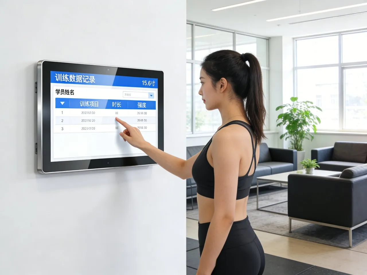
ການສະແດງແຜນທີ່ລົດໄຟໃຕ້ດິນແມ່ນເຄື່ອງມືນໍາທາງທີ່ສໍາຄັນສໍາລັບຜູ້ຂັບຂີ່ປະຈໍາວັນຫຼາຍລ້ານຄົນ, ຊີ້ນຳຜູ້ໂດຍສານແລະນັກທ່ອງທ່ຽວຜ່ານເຄືອຂ່າຍການຂົນສົ່ງທີ່ສັບສົນ. ແຕ່ແຜນທີ່ຄົງທີ່ແບບດັ້ງເດີມຫຼືການໂຕ້ຕອບດິຈິຕອນ clunky ມັກຈະສ້າງຄວາມສັບສົນ: ຜູ້ຂັບຂີ່ຕໍ່ສູ້ເພື່ອຊອກຫາເສັ້ນທາງ, ພາດລາຍລະອຽດການໂອນ, ຫຼືລົ້ມເຫລວໃນການເຂົ້າເຖິງການອັບເດດການບໍລິການແບບສົດໆ. These pain points lead to frustrated passengers, increased staff workload, and disrupted transit experiences—especially during peak hours or service disruptions.The Subway Map ຫນ້າຈໍສໍາພັດ transforms subway navigation by merging interactive functionality with transit-grade durability.
Designed specifically for high-traffic stations, this touch screen delivers intuitive route planning, real-time service alerts, and multi-language support with just a few taps. It withstands heavy use, ແສງ harsh, and environmental stressors, making it ideal for both indoor and semi-outdoor subway stations. Whether deployed in busy urban transit hubs or regional subway systems, this touch screen empowers riders to navigate independently and efficiently. ບົດຄວາມນີ້ແບ່ງອອກລັກສະນະຫຼັກຂອງຕົນ, ຜົນປະໂຫຍດ, ຄໍາຮ້ອງສະຫມັກ, and FAQs to show how it revolutionizes subway map displays.
Core Features of Subway Map Touch Screen
1. Intuitive Interactive Navigation & Route Planning
Simplifies complex subway networks for riders of all familiarity levels:
Point-to-point route search: Riders input start and end stations to get step-by-step directions, including transfer points and travel times.
ຊູມ & pan functionality: 10-point multi-touch support lets users zoom in on station details or pan across the entire network effortlessly.
Station detail display: Tapping a station shows exits, nearby landmarks, accessibility features (wheelchair ramps, elevators), and connecting bus routes.
Favorite routes save: Riders can store frequently used routes for quick access during daily commutes.
This interactivity eliminates guesswork, letting riders plan journeys in seconds without staff assistance.
2. Transit-Grade Durability & ຄວາມຕ້ານທານສິ່ງແວດລ້ອມ
Built to handle the rigors of high-traffic subway stations:
ການປົກປ້ອງດ້ານຫນ້າ IP65: ຜະນຶກເຂົ້າກັນກັບຂີ້ຝຸ່ນ, rain, and spills (e.g., ເຄື່ອງດື່ມ, cleaning agents), perfect for semi-outdoor platforms or busy lobbies.
9H ດ້ານແກ້ວ tempered: Resists scratches from bags, ກະແຈ, ແລະຜົນກະທົບອຸບັດຕິເຫດ, withstanding heavy daily use from hundreds of riders.
ຕ້ານການສ່ອງແສງ & ຈໍສະແດງຜົນຄວາມສະຫວ່າງສູງ: 1,200 nits brightness cuts through direct sunlight and station lighting, while anti-reflective coating ensures clarity.
ຄວາມທົນທານຕໍ່ອຸນຫະພູມກ້ວາງ: Operates reliably from -20°C to 60°C (-4°F ເຖິງ 140 ° F), fitting cold underground stations and hot outdoor platforms.
This durability guarantees 24/7 ການດໍາເນີນງານດ້ວຍການບໍາລຸງຮັກສາຫນ້ອຍທີ່ສຸດ, even in the busiest transit hubs.
3. Real-Time Service Integration & ແຈ້ງເຕືອນ
Keeps riders informed about subway operations and disruptions:
Live service updates: Syncs with transit management systems to display real-time train arrival times, delays, and route changes.
Color-coded alerts: Highlights disruptions (detours, closures, overcrowding) with bold notifications to help riders adjust plans.
Emergency announcements: Integrates with subway PA systems to display critical alerts (safety drills, incidents) directly on the screen.
Scheduled maintenance alerts: Notifies riders of upcoming service changes in advance to avoid last-minute delays.
This feature ensures riders stay informed and can make timely decisions about their journeys.
4. Multi-Language & Accessibility Support
Caters to diverse riders, including tourists and those with disabilities:
20+ ຕົວເລືອກພາສາ: Offers English, ສະເປນ, ພາຄິ້ວ, ພາສາອາຣັບ, ຝຣັ່ງ, and more to serve international tourists and multilingual communities.
ຄຸນລັກສະນະການເຂົ້າເຖິງ: ໂໝດຄວາມຄົມຊັດສູງ, text-to-speech compatibility, and large font options for riders with visual impairments.
Wheelchair-accessible routes: Identifies fully accessible stations and routes for riders with mobility needs.
Simple icon-based design: Reduces language barriers with universal icons for routes, transfers, ແລະສິ່ງອໍານວຍຄວາມສະດວກ.
This inclusivity ensures every rider can use the map display independently, regardless of background or ability.
5. ການບໍລິຫານໄລຍະໄກ & ຄວາມເຂົ້າໃຈດ້ານການປະຕິບັດງານ
Eases transit agency workflows and optimizes display performance:
Remote content updates: Transit teams push map updates, service changes, or new language options without on-site visits.
Real-time status monitoring: Tracks screen performance, ສໍາພັດຄວາມຮັບຜິດຊອບ, and connectivity to identify issues early.
ການວິເຄາະການນໍາໃຊ້: Captures data on popular routes, peak usage times, and language preferences to optimize display placement and features.
ໂໝດລັອກທາງໄກ: Enables secure shutdown during emergencies or maintenance periods to protect the screen.
This functionality reduces downtime and cuts operational costs for transit agencies.
Key Benefits of Subway Map Touch Screen
1. Enhance Rider Satisfaction & Reduce Inquiries
A smoother navigation experience translates to happier riders and lighter staff workloads:
Cut journey planning time by 50%: Intuitive tools let riders find routes faster, reducing frustration during peak hours.
Minimize staff assistance requests: Self-service navigation frees staff to focus on critical tasks (e.g., assisting disabled riders, managing crowds).
Cater to tourists: Multi-language support and simple interfaces make subway systems accessible to international visitors.
Improve transit reputation: ທັນສະໄຫມ, interactive maps create a positive first impression of the subway network.
2. ຄ່າໃຊ້ຈ່າຍໃນການປະຕິບັດງານຕ່ໍາ & Maintenance Efforts
Transit agencies save time and resources with a durable, low-maintenance solution:
Reduce maintenance visits: ການອອກແບບທີ່ທົນທານແລະການວິນິດໄສຫ່າງໄກສອກຫຼີກລົບລ້າງ 50% ໂທສ້ອມແປງຢູ່ບ່ອນ.
Extend display lifespan: ອົງປະກອບຊັ້ນຮຽນຂອງອຸດສາຫະກໍາແມ່ນ 5-7 ປີ, outperforming consumer-grade touch screens.
Optimize staff allocation: Usage analytics help place displays in high-demand areas, maximizing their utility.
Cut update costs: Remote content updates avoid the expense of replacing static maps or sending teams to each station.
3. Improve Transit Efficiency & Crowd Management
Streamlines passenger flow and reduces congestion in stations:
Reduce crowding at information desks: Riders use touch screens instead of clustering around staff for directions.
Speed up decision-making: Real-time alerts let riders adjust routes quickly, preventing bottlenecks at stations.
Optimize transfer flow: Clear transfer directions help riders move between lines efficiently, reducing platform overcrowding.
Support contactless options: Integrates with QR code scanners, letting riders save routes to their phones without repeated touch interactions.
4. Future-Proof Subway Infrastructure & ຢວກ
Adapts to evolving transit needs and rider expectations:
Support network expansions: Easily update maps to include new stations, lines, or routes post-installation.
Integrate emerging tech: Compatible with mobile app syncing, voice control, and smart wearables for next-level navigation.
Align with sustainability goals: Digital displays reduce paper map waste, supporting transit agencies’ eco-initiatives.
Scale across the network: Works for all station types—from busy urban hubs to small regional stops—for consistent rider experiences.
Practical Applications for Different Subway Scenarios
1. Urban Mega-Transit Hubs
For busy city subway systems (e.g., New York, Tokyo, London) with complex networks:
Handle high daily ridership with durable screens that withstand constant use from thousands of passengers.
Support multi-line transfers with clear route planning tools for riders navigating complex interchange stations.
Offer 20+ language options to cater to diverse urban populations and international tourists.
2. Regional Subway & Light Rail Systems
For smaller networks serving suburban areas or mid-sized cities:
Simplify core features for riders who primarily use 1–2 lines for daily commutes.
Withstand outdoor conditions for semi-outdoor platforms common in regional transit systems.
ເປີດໃຊ້ 24/7 self-service navigation for riders using early-morning or late-night trains.
3. Tourist-Focused Transit Zones
For subway stations near landmarks, ສະຫນາມບິນ, or tourist districts:
Prioritize multi-language support (including tourist-heavy languages like Japanese, Korean, and German).
Display nearby attractions and walking directions to help tourists connect subway rides to destinations.
Integrate airport shuttle schedules to assist travelers transitioning between subways and flights.
4. Subway Renovation & Modernization Projects
For transit agencies updating outdated station infrastructure:
Offer plug-and-play integration with existing transit management systems for seamless setup.
Fit into existing station layouts with compact, flexible mounting options (ຝາ, ທຸຕ້າ, ແປ້ນ).
Enable phased installation to align with renovation timelines and minimize disruption to riders.
FAQs About Subway Map Touch Screens
q1: Will this touch screen integrate with our existing subway transit management system?
A1: ແລ້ວ! It supports standard industrial protocols and syncs with leading transit management platforms. Our team verifies compatibility and provides seamless integration for your network.
Q2: Can the screen operate in direct sunlight or dim underground stations?
A2: ຢ່າງເດັດຂາດ. ນໍາ 1,200 nits ຄວາມສະຫວ່າງແລະການເຄືອບຕ້ານ glare, it maintains clarity in direct sunlight, while high contrast ensures visibility in dim underground environments.
Q3: How often do we need to clean or maintain the screen in high-traffic stations?
A3: The smooth, IP65-sealed surface is easy to clean—daily wiping with standard disinfectants suffices. Its rugged design minimizes maintenance, with only occasional calibration needed.
Q4: Can riders use the screen with gloves during cold weather?
A4: ແລ້ວ. The touch screen is optimized for gloved-hand operation (winter, ຖາວ, or work gloves), so riders don’t need to remove handwear to navigate.
Q5: What warranty and support are included for subway applications?
A5: ທຸກໆແບບປະກອບມີການຮັບປະກັນ 3 ປີເຊິ່ງກວມເອົາຂໍ້ບົກພ່ອງຂອງຮາດແວ, ສໍາພັດຄວາມຮັບຜິດຊອບ, and weather resistance. ມີການຮັບປະກັນ 5 ປີ, ນໍາ 24/7 technical support for transit agencies.
ສະຫຼຸບ
The Subway Map Touch Screen redefines subway navigation by merging intuitive interactivity, transit-grade durability, and real-time functionality to enhance rider experiences and streamline operations. It eliminates confusion, reduces staff workloads, and adapts to the unique demands of high-traffic transit hubs—from complex urban networks to regional systems. For transit agencies looking to modernize their infrastructure and prioritize rider satisfaction, this touch screen is a critical investment.
Ready to upgrade your subway map displays with interactive, ຫນ້າຈໍສໍາພັດທົນທານ? Fill out the form on our website to connect with our transit technology experts. We’ll assess your network’s needs, verify system compatibility, and recommend a customized Subway Map Touch Screen solution. ມາສ້າງສະຫຼາດຂຶ້ນ, more rider-friendly subway systems—start today!